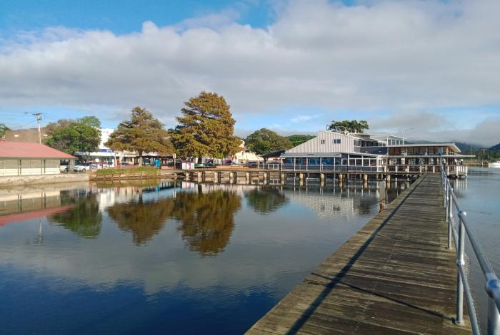
Central Coast Council is preparing a Floodplain Risk Management Study and Plan (FRMSP) for the Woy Woy Peninsula including Kahibah Creek catchment.
A draft Study and Plan has now been finalised following detailed analysis of the feedback we received from our first round of community consultation in early 2021 and an assessment of potential flood risk management measures.
The draft reports were on public exhibition for a period of four weeks from 18 January - 15 February 2023 to get community feedback before the draft plan is finalised and adopted by Council in late 2023.
This study has been prepared by specialist flood consultants DHI Group and Rhelm Pty Ltd and is jointly funded by Council and NSW Government Department of Planning and Environment (DPE), through their Floodplain Management Program.
How to get involved
The community were invited to:
- Review the draft study and plan: Take a look online in the document library on the right of this page or hardcopy of the draft reports at Woy Woy Library and Umina Library.
- Attend a community drop-in session: Country Women’s Association Hall (30/32 The Boulevarde, Woy Woy): Wednesday 1 February 2023, 4.00pm-6.30pm.
- Read our frequently asked questions: Make sure you check out the frequently asked questions on our main floodplain management page to see if we haven't already answered your question!
- Book in a project officer call-back: Book an information session time where you can speak to a project officer about any questions or submission comments relating to the project.
- Fill out the online submission form (now closed): If you have some feedback that you would formally like to provide Council on the draft study and plan, fill out our submission form and it will be evaluated before we finalise the document.
The exhibition was open until 5pm Wednesday 15 February 2023 and community feedback was provided by:
- Email: FloodManagement@centralcoast.nsw.gov.au
- Post: PO Box 20, Wyong NSW 2259 (Addressed to Smita Nepal, Floodplain Management)
- Our online submission form (now closed).
Late submissions were accepted until 22 February via direct email to FloodManagement@centralcoast.nsw.gov.au
Your attention is drawn to the provisions of the Government Information (Public Access) Act 2009 which allows for possible access to certain public and personal documentation. View our privacy statement.
Got a question?
Check out the frequently asked questions on our flood page or contact one of our project officers listed on the right.
*This website does not necessarily represent the opinions of the NSW Government or the Department of Planning and Environment (DPE).
Links
Segmented Documents
Council Meeting Documents
Consultation results
Executive Summary
Exhibited Documents
Timeline
Who's listening
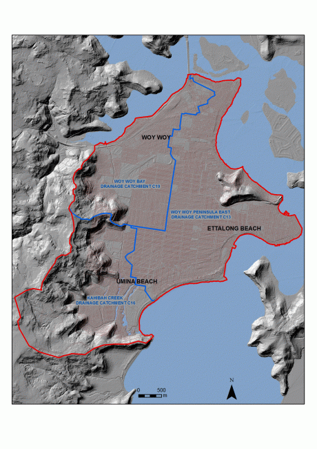
What is the Woy Woy Peninsula study area?
The Woy Woy Peninsula (the Peninsula) urban area is bounded by Brisbane Water to the north and east, Broken Bay to the south, and Brisbane Water National Park to the west. The study area is approximately 18.5 km2.
Is the Woy Woy Peninsular prone to flooding?
The Woy Woy Peninsula is prone to nuisance flooding, especially from long-duration rainfall events. Flooding occurs in the road reserves and in private property, where it remains until it infiltrates or evaporates. Generally, this flooding may remain for a couple of days. However, during very wet periods the groundwater table can rise such that flooding remains for several weeks.
Flooding is also caused by creek flooding during large rainfall events, as well as inundation from ocean storms.
What is the Flood Risk Management Study (FRMS)?
The FRMS (DHI, 2022), examined options for managing flood risk in the Woy Woy Peninsula. This FRMP (DHI, 2022) outlines the floodplain management measures recommended as an outcome of the assessment undertaken in the FRMS along with the implementation strategy associated with those measures.
What other studies have been conducted?
In addition to the FRMS, the following associated studies were undertaken on behalf Council for the purpose of preparing this FRMP:
- Woy Woy Climate Change Adaptation Study (Rhelm, 2021b) to identify feasible strategies to adapt the low-lying areas of Woy Woy to the impacts of sea level rise.
- Woy Woy Integrated Water Management Cycle and Case Study Everglades Catchment (DHI, 2021) to define flooding in this catchment utilising an integrated surface water and ground water model and identify potential solutions to mitigate flooding.
The findings of these studies were also considered in the recommendations presented in the FRMP.
Flood risk from ocean storm flooding was assessed as part of the Brisbane Water Floodplain Risk Management Study (Cardno, 2015). The outcomes of the 2015 study have been used to inform the assessment of several local floodplain risk management measures as part of these FRMS and FRMP.
Flood risk associated with catchment flooding has been presented in this current study in terms of Flood Hazard, Hydraulic Categorisation, and flood impacts on roads. Emergency Response Classification has been assessed with regards to both catchment flooding and flooding from Brisbane Water.
What community consultation has been undertaken?
At the start of this current study, in March 2021, residents of Woy Woy Peninsula were invited to answer a questionnaire which was designed to provide Council with information on flooding problems they are aware of and suggestions on how they would like to see these problems addressed.
One face to face information session was also held at CWA hall in March 2021 to engage with the community on the flooding issues within the catchments and discuss some of the recommended flood management options.
A draft of the Woy Woy Peninsula Floodplain Risk Management Study and Plan has now been finalised following detailed analysis of the feedback we received from our first round of community consultation in 2021, and an assessment of potential flood risk management measures has been completed.
How were the community invited to have their say?
The draft Woy Woy Peninsula Floodplain Risk Management Study and Plan was on public exhibition for a period of four weeks from 18 January 2023 to 5pm Wednesday 15 February 2023.
The community were invited to:
- Review the draft study and plan: Take a look online in the document library on the right of this page or hardcopy of the draft reports at Woy Woy Library and Umina Library.
- Attend a community drop-in session: Country Women’s Association Hall (30/32 The Boulevarde, Woy Woy): Wednesday 1 February 2023, 4.00pm-6.30pm.
- Read our frequently asked questions: Make sure you check out the frequently asked questions on our main floodplain management page to see if we haven't already answered your question!
- Book in a project officer call-back: Book a information session time where you can speak to a project officer about any questions or submission comments relating to the project.
- Fill out the online submission form (now closed): If you have some feedback that you would formally like to provide Council on the draft study and plan, fill out our submission form and it will be evaluated before we finalise the document.
The exhibition was open until 5pm Wednesday 15 February 2023 and community feedback was provided by:
- Email: FloodManagement@centralcoast.nsw.gov.au
- Post: PO Box 20, Wyong NSW 2259 (Addressed to Smita Nepal, Floodplain Management)
- Our online submission form (preferred).

