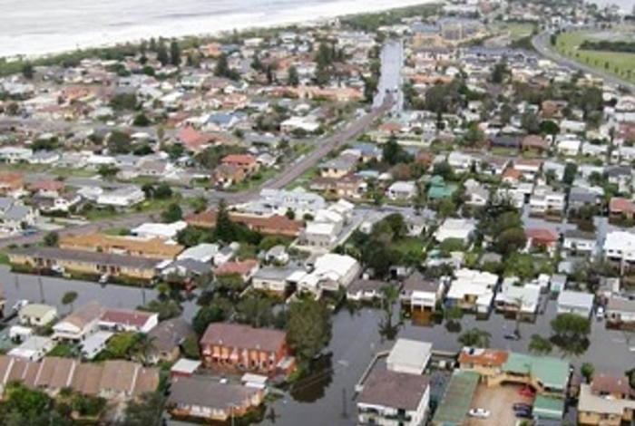
Wyong River Floodplain Risk Management Study and Plan
The Wyong River Floodplain Risk Management Study and Plan has been prepared by Central Coast Council with the assistance of funding from the NSW Government (through the NSW Floodplain Management Program) to evaluate the management options available to manage the impacts of flooding in this catchment area.
In recognition of the flooding problems confronting the Wyong River catchment, Council commissioned consultants to prepare a Floodplain Risk Management Study and Plan for the catchment. The primary goal of the project is to quantify the nature and extent of the existing flooding problem and evaluate options that could be potentially implemented to manage the existing, future and continuing flood risk.
The study and plan updates and expands upon the ‘Lower Wyong River Floodplain Risk Management Study’ and ‘Lower Wyong River Floodplain Risk Management Plan’ (Paterson Consultants, 2010) that focussed on the lower (i.e. downstream) sections of the Wyong River catchment only. However, it should be noted that this study excludes the Porters Creek sub catchment as well as the Tuggerah Lake foreshore areas, which were included in the ‘Porters Creek Floodplain Risk Management Study’ (Cardno, 2011) and ‘Tuggerah Lakes Floodplain Risk Management Study and Plan’ (WMAwater, 2014) respectively.
Status of study and plan
The final study and plan has now been adopted by Council and can be viewed on Council's strategies and plans page.
The draft study and plan was placed on exhibition from 25 March until 26 April 2019 at Council's Wyong and Gosford offices (Monday – Friday, 8:30am-5pm) and online. During this time, community members were invited to provide feedback on the draft Wyong River Floodplain Risk Management Study and Plan. Drop-in information sessions for the community to discuss the study and plan with staff were also held.
About the Wyong River catchment
The Wyong River catchment occupies a total area of 440 km2.
The catchment is drained by a network of rivers and creeks including Wyong River, Cedar Brush Creek, Jilliby Creek, Porters Creek, Mardi Creek and Deep Creek, which ultimately drain into Tuggerah Lake. Tuggerah Lake, in turn, discharges into the Pacific Ocean via a single outlet at The Entrance.
During periods of heavy rainfall within the catchment, there is potential for water to overtop the banks of the various watercourses and inundate the adjoining floodplain. The catchment has a long history of flooding including significant events in 1949, 1964 and 1977 as well as more recently in 2007.
Got a question?
Check out the frequently asked questions on our flood page.

