Lake Macquarie Catchments - Overland Flood Study
About the project
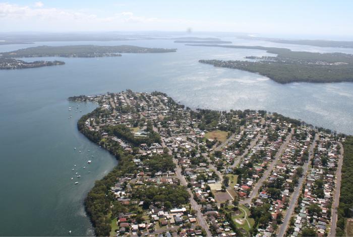
With the support of the NSW Government’s Floodplain Management Program, Central Coast Council is preparing an Overland Flood Study for each of the contributing catchments within the Central Coast Local Government Area that drain into Lake Macquarie.
Flooding has the potential to cause considerable damage and disruption to a community. In addition to tangible damage, floods also impose high levels of intangible damage such as increased levels of stress on affected communities.
The objective of this comprehensive technical investigation is to define flood behaviour and impacts within the study area. The study will focus on flooding of creeks and overland flow paths caused by heavy rainfall and will consider the influence of water levels in Lake Macquarie on such flooding. The information gathered from this flood study will better inform management of flood risk in the study area and will be used as the basis of a future floodplain risk management study.
The study is being prepared by the consultant BMT.
About the Lake Macquarie Catchments
The study area consists of a series of catchments within the northern end of the Central Coast Local Government Area that each drain into Lake Macquarie. These contributing catchments have a combined size of approximately 30km2 and include the suburbs of:
- Mannering Park
- Doyalson
- Doyalson North
- Kingfisher Shores
- Chain Valley Bay
- Lake Munmorah
- Crangan Bay
- Summerland Point
- Gwandalan
- Point Wolstoncroft
The major watercourses within the study area are Karignan Creek, Tiembula Creek and Bonny Boy Gully, with the remaining areas drained by natural channels, constructed drainage canals and stormwater systems comprised of underground pipes and overland flow paths.
The dominant cause of creek and overland flooding is intense rainfall, while foreshore flooding from Lake Macquarie can be driven by elevated ocean conditions (tide and storm surge), long durations of rainfall, and local wind waves.
Community consultation
Involving the community is essential to the success of the overall floodplain risk management process. Understanding how and where past flood events have impacted the community helps identify flooding “trouble spots” to allow for a targeted assessment of where flood risk reduction measures would be best implemented in future.
Council invited all residents within the study area to complete a questionnaire prepared by the consultant. A printed version of the questionnaire was delivered to residents and property owners in identified areas included in the study. The questionnaire was also made available online.
The survey has now closed, and the consultant has reviewed all the valuable responses that were received. Thank you to all residents who took the time to complete the questionnaire and contributed to the study.
Got a question?
Check out the frequently asked questions on our flood page.

